
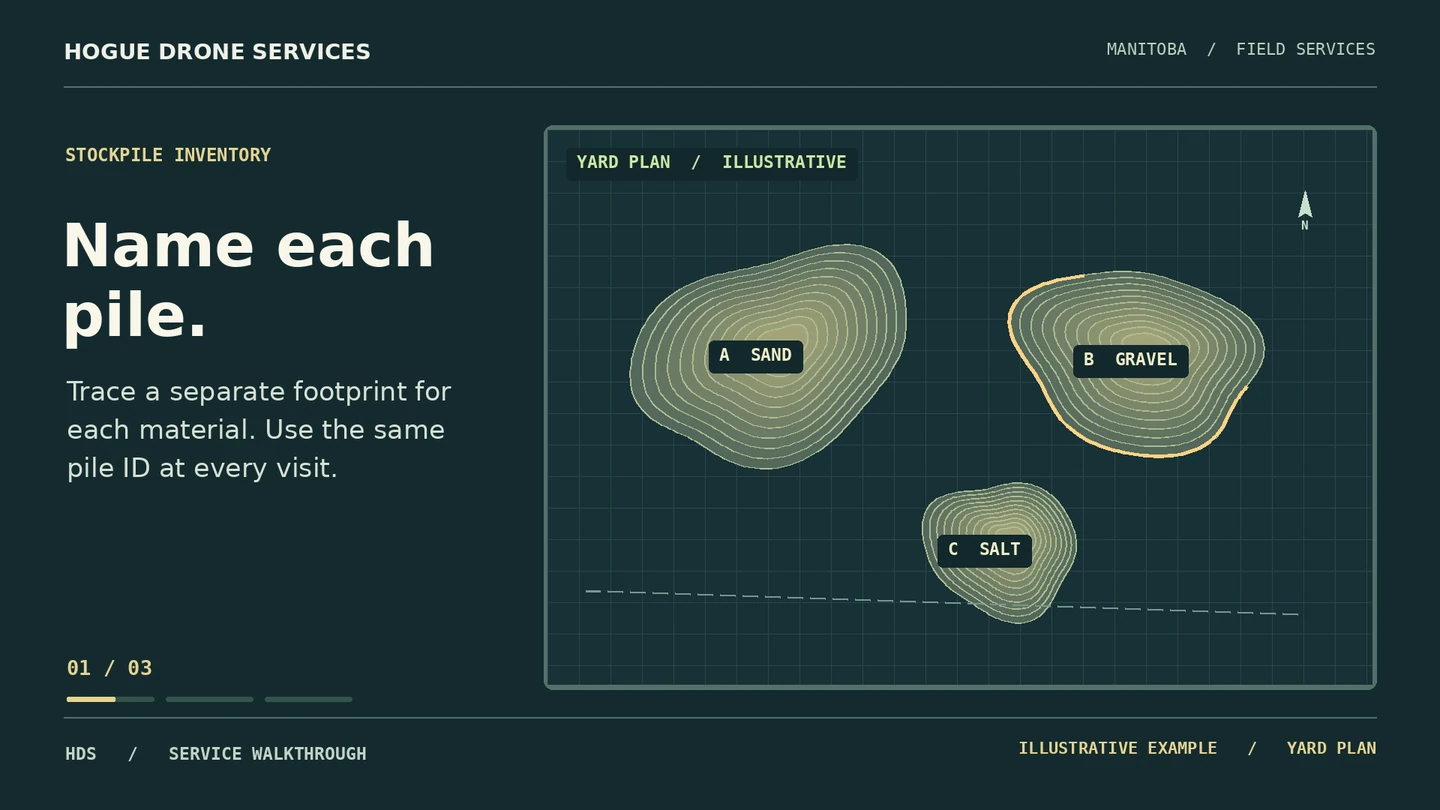
Numbered yard map
A visual index identifies each pile, its material label and capture date.
FIELD RECORDS & MAPS / HOGUE DRONE SERVICES
Put a number on each pile and follow what changes from month to month.
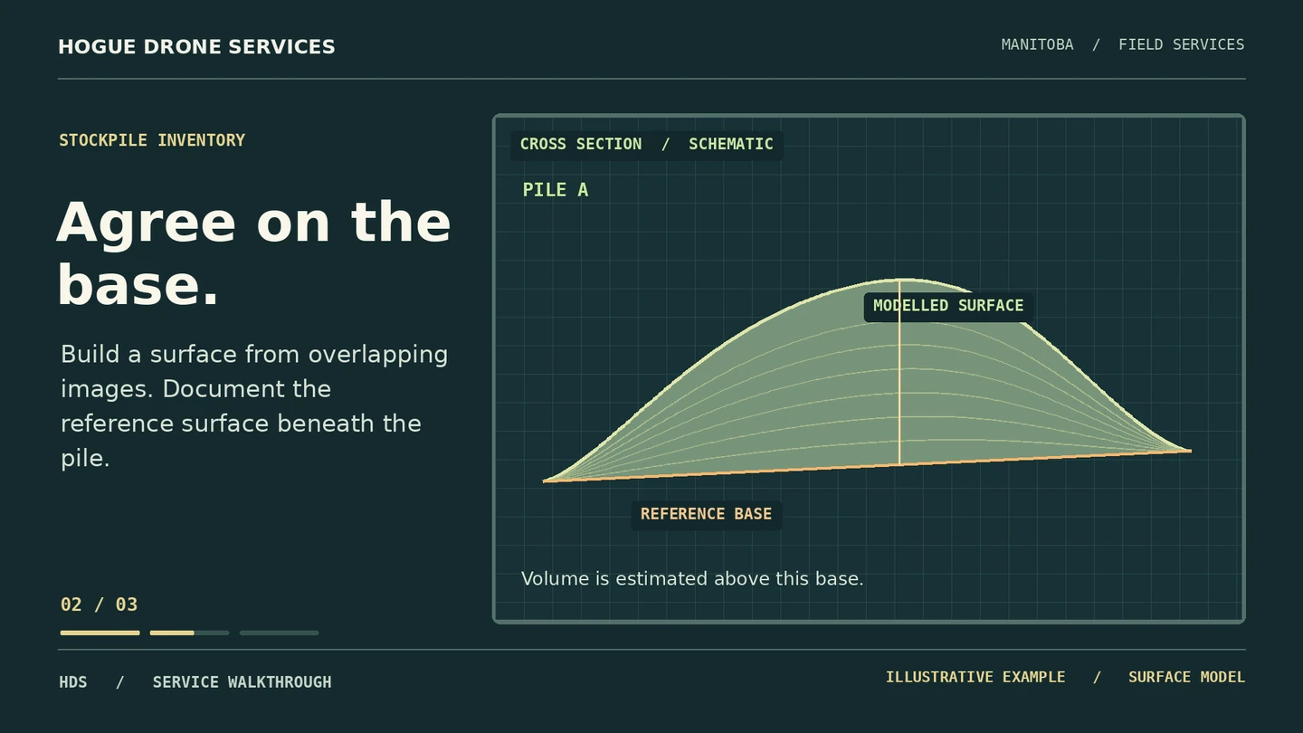
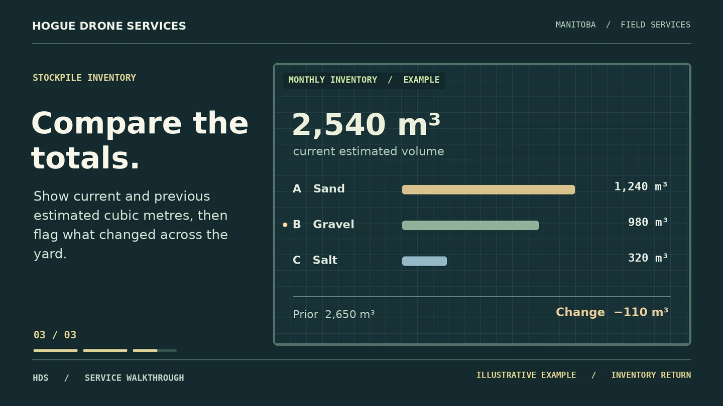
An illustrated yard demonstrates pile IDs, base assumptions and a sample comparison. Figures are illustrative.
01 / PROJECT BRIEF
A yard manager needs to know which pile changed and by how much. We agree on the measurement method first, capture the yard, then deliver a numbered map and a volume estimate for each agreed pile.
Who it’s for Snow contractors, landscape suppliers, gravel yards and aggregate operations.
A visual index identifies each pile, its material label and capture date.
A spreadsheet of estimated cubic metres by pile, with the assumed base surface, exclusions and relevant check information.
A comparison with the previous accepted capture. We flag areas disturbed during the flight or hidden by equipment.
02 / VISUAL WALKTHROUGH
03 / FROM BRIEF TO DELIVERY
Choose a pile with an independent reference quantity. Agree on access, base information, checks and an acceptable tolerance.
Coordinate flights with loaders and incoming trucks. Record the capture time and any active material movement.
Review the estimate against the reference. Once the method is suitable, establish repeat visits and consistent pile IDs.
BOOK WITH ERIC HOGUE
Send yard location, material types, pile count, known reference information and intended use. We’ll confirm the scope, timing and full price before booking.